Pointer Planetarium
OmgSlayKween
Watchapp
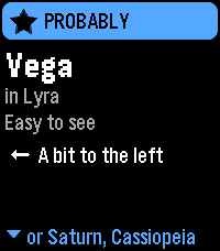
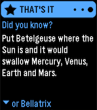
Description
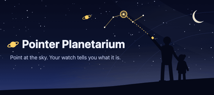
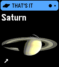
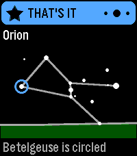
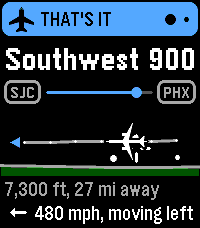
Point at almost anything in the sky, and Pointer Planetarium will tell you what it is, and often includes an interesting fact. Categories the app knows about:

Planes (private, commercial, military)
Planets (with images for all of them)
Satellites (Hubble, Starlink trains, comms satellites)
Space Stations (ISS & Tiangong)
Space junk (e.g. rocket boosters still in orbit)
Stars (~3,000 named & unnamed)
Constellations (all 88)

Don't know where to look? It can guide you, with a "Find It" mode. Anything you find is recorded in the Logbook, in Pointer Planetarium's settings page in the Pebble phone app.

Pointer Planetarium stands on the work of many astronomers, agencies and open-data projects:

Stars: Yale Bright Star Catalogue, 5th Revised Edition (Hoffleit and Warren 1991, CDS VizieR V/50). Star names from the IAU Working Group on Star Names (WGSN, CC BY), as mirrored by E. Mamajek. Star distances from Hipparcos (ESA 1997, VizieR I/239).
Constellations: boundaries from N. G. Roman (1987, PASP 99, 695; VizieR VI/42). Stick figures from Marc van der Sluys, ConstellationLines (CC BY 4.0, adapted).
The Moon and planets: positions after Paul Schlyter's "How to compute planetary positions"; Mercury and Venus brightness after Mallama and Hilton (2018).
Pictures: public domain NASA images: Mercury (MESSENGER, PIA11364), Venus (Mariner 10, PIA23791), Mars (Hubble Heritage Team), Jupiter (Cassini, PIA02873), Saturn (Cassini, PIA06193), Uranus and Neptune (Voyager 2, PIA18182 and PIA01492), and the Moon (NASA's Scientific Visualization Studio). Their use doesn't imply NASA's endorsement.
Magnetic north: the World Magnetic Model 2025 (NOAA NCEI and the British Geological Survey, public domain), evaluated with code ported from magvar (MIT, Darren Yeates).
Satellites: orbits from CelesTrak (from Space-Track.org data), computed with satellite.js (MIT).
Planes: live positions from adsb.lol (ODbL) and adsb.fi (non-commercial use). Airlines, airports, aircraft types and routes from Virtual Radar Server's standing data (CC0).
Places in the logbook: Natural Earth populated places (public domain).
Fun facts are written for this app, with numbers from NASA fact sheets, the IAU and aircraft makers.

PRIVACY:
Aiming in PLANES or ANYTHING mode sends your location, rounded to about half a mile, to the plane data service (adsb.lol or adsb.fi). Turn planes off in the settings and your location never leaves your phone.
Satellites and plane names are downloaded without your location.
Your location is also kept on the watch so it can work without the phone. It stays on the watch.
The logbook stays on your phone, with places rounded to about 6 miles.
There are no accounts, ads, analytics or tracking of any kind. The code is free, open-source, and MIT-licensed.
- DeveloperOmgSlayKween
- CategoryTools & Utilities
- PlatformsTime 2
- Updated2026-10-14
- Version1.0